Stewart Island Maps and Brochure

Stewart Island/Rakiura is situated south of New Zealand's South Island. It lies 30 kilometres south west of Bluff between latitudes 46 and 47 degrees south.

View the latest digital version of our brochure / directory


Paper copies of this brochure can be obtained by contacting VISITOR POINT


Tramping Maps

are available from the Rakiura National Park Visitor Centre.

Maps


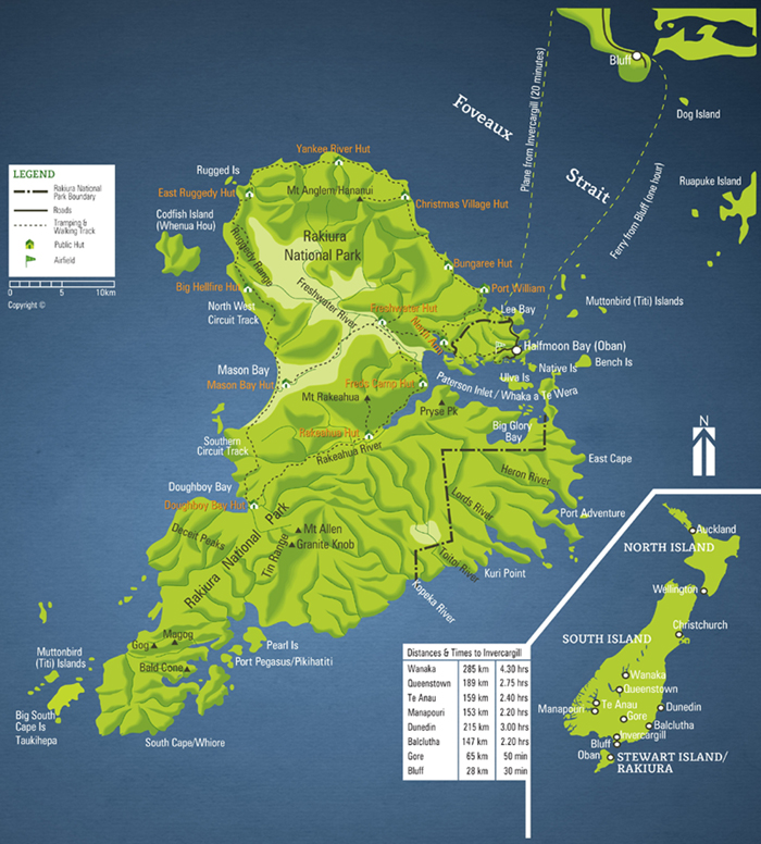
A paper version of the Stewart Island street map is freely available at many locations on the island or click the street map below to download a PDF version (2.7MB). 

Two overview maps are also available to download.

2024 Stewart Island street map A4 pad Stewart Island NZ Map
Stewart Island overview map